Bridging the Gap between BIM and GIS
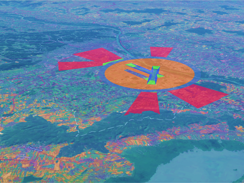
Bridging the Gap between BIM and GIS The OLS-project. How can digital building models be validated for air safety-compliance in the vicinity of airports? A UNIGIS master thesis. Figure 1: Model of OLS at Vienna airport In my master thesis titled “BIM- and GIS-Integration for the semi-automatic check of [...]

Mit Erasmus+ bei UNIGIS América Latina
Christoph Traun, Studienleiter von UNIGIS professional, unterrichtete über das Erasmus+ Programm an der Universidad San Francisco de Quito (USFQ) und nutzte dort die Gelegenheit unsere dortigen UNIGIS-Partner von UNIGIS América Latina zu treffen.

UNIGIS-Link des Monats – Voll Retro in die Zukunft
Der Link des Monats ist eine seit 2011 gewachsene Sammlung an diversen GIS-bezogenen Links - und sie wächst weiter. Vormals auf der UNIGIS Studienorganisations-Seite des UNIGIS professionals zusammengetragen, finden Sie den Link des Monats nun auf unserer Website. Seien Sie gespannt auf viele neue Highlights!

War in Europe! How has Agriculture Changed in the Context of the Ukraine Conflict? A Remote Sensing Approach in a UNIGIS Master Thesis.
Torge Brunhorn's UNIGIS master thesis deals with the war in Ukraine and its impact on agriculture. Using remote sensing methods, interesting results are generated that provide a more detailed insight into this conflict. Climatological methods are also used for a more precise assessment.

Esri UC – The Geeky Wonderland You Never Knew You Needed!
Have you ever wondered what the Esri UC with 18.000 GIS geeks meeting in one place is like? Petra takes you along a journey through this year's UC in sunny San Diego.

UNIGIS at GI_Salzburg 2023 – A Throwback
We are looking back at the GI_Salzburg 2023, THE Geoinformatics conference in Salzburg. Read about the UNIGIS Forum, Get-Together, and other highlights from UNIGIS @ GI_Salzburg23. You can also find infos on GI_Salzburg24 at the end.